Download presentation
Presentation is loading. Please wait.

1
* The relative measure of the amount of water vapor in the air * Psychrometer – measures the humidity * Water vapor affects the density of the air. * Cold air is heavier than warm air.

3
* A body of air that has the same temperature and humidity throughout.

4
* If a large body of air sits over an area of land or water for a long period of time, it will take on the characteristics of the land or water beneath it. * Temperature * Humidity

5
* Air masses over the equator will have high temperatures. * Air masses over polar regions will have low temperatures. * Air masses over water (maritime) will have high humidity (moisture content). * Air masses over land (continental) will have low humidity (moisture content).
 will have high humidity (moisture content). * Air masses over land (continental) will have low humidity (moisture content)..")
6
* Air masses tend to form in areas with little wind. * Remember, they sit over an area for a long period of time without moving.

7
maritime * Air masses that form over water are called maritime. continental * Air masses that form over land are called continental.

8
* mT * mT – maritime tropical * cT * cT – continental tropical * mP * mP – maritime polar * cP * cP – continental polar * cA * cA – continental arctic

10
* mT * mT – warm, moist air * cT * cT – warm, dry air * mP * mP – cold, moist air * cP * cP – cold, dry air * cA * cA – super cold, dry air

11
Convection!

12
* Warm air rises, and cold air moves in to replace it. * A circulation pattern is formed. * Causes air and water currents to form

13
Density! * Warm air rises. * Cool air sinks.

14
How do different air masses form?

16
* Weather maps are used to show current weather conditions in an effort to predict future weather conditions. * You need to know what each symbol means and how to interpret them to forecast the weather.

18
* Cold, dense air is moving toward warm, less dense air. * The warm air is pushed up to cool and form clouds as the cooler air replaces it. * The air on the front side of the boundary line is warmer than the air on the back side of the boundary line. * These fronts are usually fast moving and bring stormy weather and heavy precipitation followed by clearing skies and higher pressure.

20
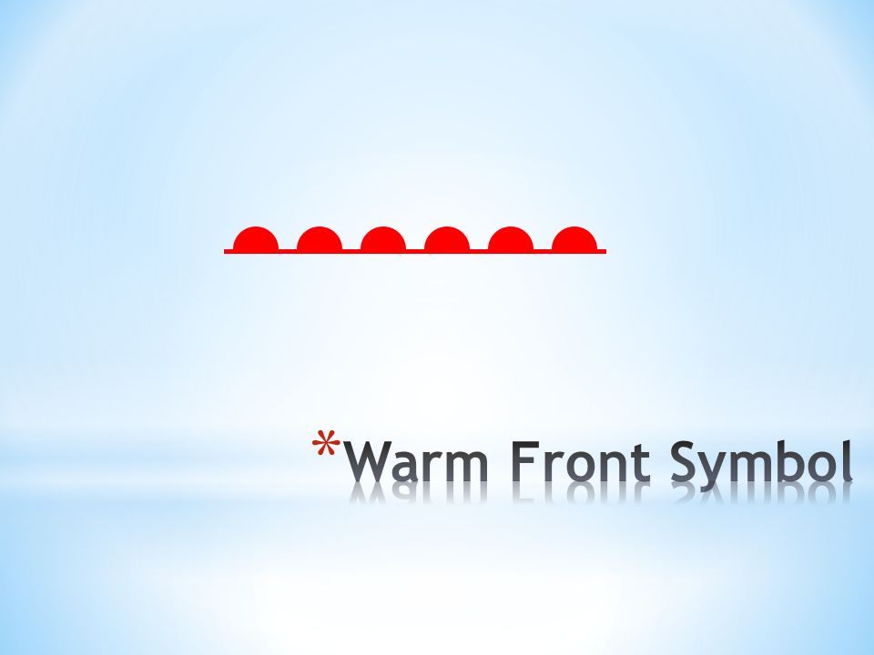
* Warm air is moving toward cold air. * The warm, less dense air slides over the cold, more dense air. * The air on the front side of the boundary line is cooler than the air on the back side of the boundary line. * These fronts usually move slowly and bring steady rain or snow over many days.

22
* These fronts occur when neither the cool or warm air masses are strong enough to replace each other. * They tend to stay in an area for a long period of time, often bringing long periods of precipitation and clouds.

24
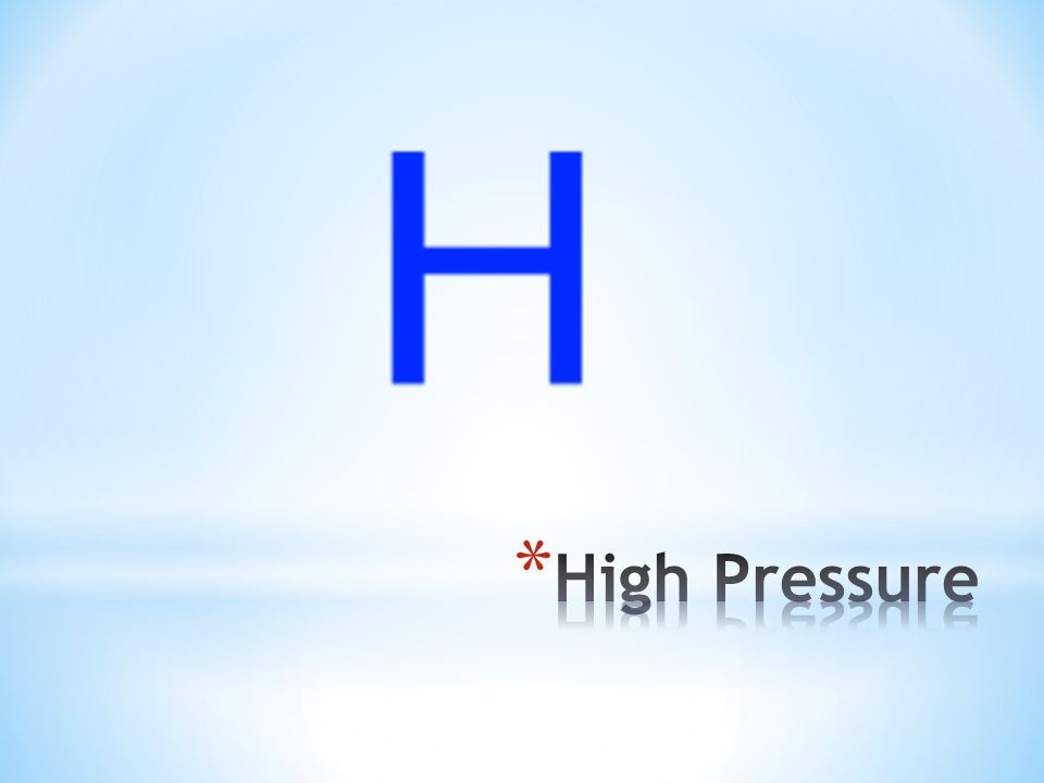
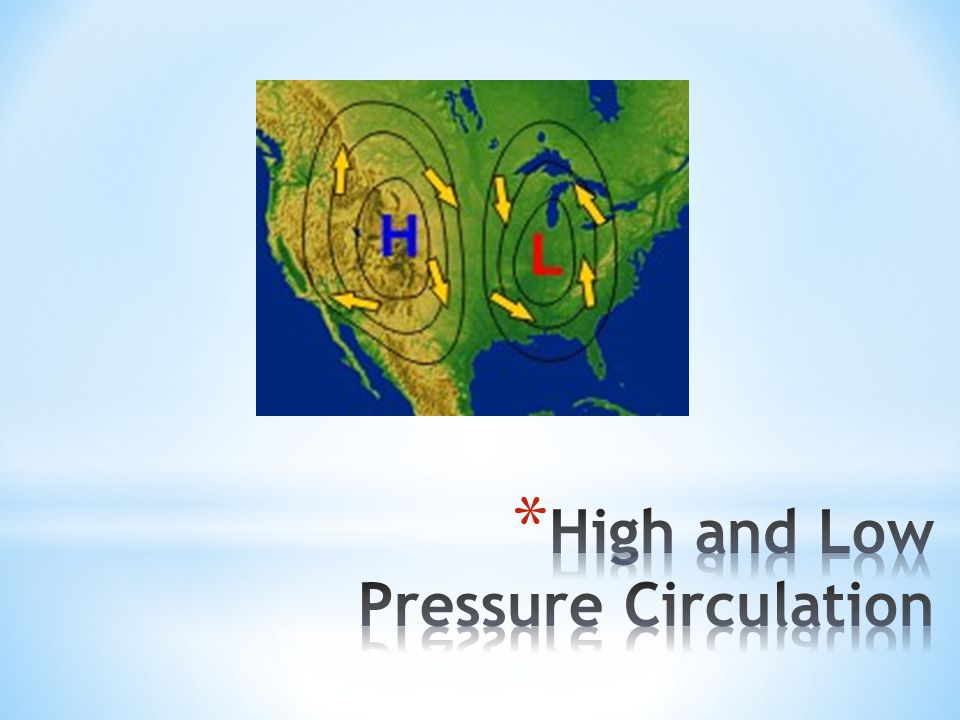
* Cooler, dense air close to the surface of the Earth. * Surrounded by winds flowing in a clockwise direction. * Usually brings dry conditions and fair skies.

26
* Warmer, less dense air above the Earth’s surface * Surrounded by winds moving in a counterclockwise direction. * Associated with the formation of storms.

29
Why does the Earth have weather? How do weather maps show how global patterns of atmospheric movement influence local weather?

Similar presentations